Text
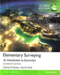
Elementary surveying an introduction to geomatics
This 14th Edition of Elementary Surveying: An Introduction to Geomatics is a readable text that presents basic concepts and practical material in each of the areas fundamental to modern surveying (geomatics) practice. It is written pri¬marily for students beginning their study of surveying (geomatics) at the college level. Although the book is introductry to the practice of surveying, its depth and breadth also make it ideal for self-study and preparation for licensing examina¬tions. This edition includes more than 400 figures and illustrations to help clarify discussions, and numerous example problems are worked to illustrate compu¬tational procedures. Recognizing the proliferation of intelligent phones and the intention of Internet browsing ability in these phones and tablet devices, QR Codes have been introduced with this edition. These codes indicate that a video lesson on the material is available from the companion website for this book at www.pearsonglobaleditions.com/ghilani and are accessible using a smart phone or other device with a QR code reader. The 65 videos provide complete, step-by-step solution walkthroughs of representative problems from the text and proper instrumentation procedures to use when in the field. These videos also provide additional assistance for students when working with equipment during home¬work and field exercises or in preparing for an exam or quiz. Please note: Users must download a QR code reader to their smartphone or tablet. Data and roaming charges may also apply.
In keeping with the goal of providing an up-to-date presentation of surveying equipment and procedures, total stations are stressed as the instruments for making angle and distance observations. With this in mind, a section on planning a ground-based laser scanning survey has been introduced in this edition. Additionally, the LandXML format to exchange mapping files has also been introduced.
Ketersediaan
Informasi Detail
- Judul Seri
-
-
- No. Panggil
-
526.9 Ghi e
- Penerbit
- London : Pearson., 2015
- Deskripsi Fisik
-
960 hal. : il. ; 25 cm.
- Bahasa
-
English
- ISBN/ISSN
-
9781292060491
- Klasifikasi
-
526.9
- Tipe Isi
-
-
- Tipe Media
-
-
- Tipe Pembawa
-
-
- Edisi
-
Ed. XIV
- Subjek
- Info Detail Spesifik
-
-
- Pernyataan Tanggungjawab
-
-
Versi lain/terkait
Tidak tersedia versi lain
Lampiran Berkas
Komentar
Anda harus masuk sebelum memberikan komentar

 Karya Umum
  Filsafat
  Agama
Agama  Ilmu-ilmu Sosial
  Bahasa
  Ilmu-ilmu Murni
  Ilmu-ilmu Terapan
  Kesenian, Hiburan, dan Olahraga
  Kesusastraan
  Geografi dan Sejarah